For most first visits to the Peak District, the White Peak is the easier area to build a trip around. It has more towns and villages, a wider choice of short and medium walks, traffic-free cycle trails, and more alternatives when the weather changes. The Dark Peak is the better choice when moorland, gritstone edges, climbing, or a longer hill day is the reason for going.
These are broad landscape areas within the same National Park, not separate destinations with a clear boundary between easy and hard. The White Peak covers the limestone country across the centre and south, where paths cross farmland or follow dales cut into the plateau. The Dark Peak takes in much of the higher gritstone and moorland country to the north and around the limestone core. Its routes generally involve more exposure and longer stretches away from roads, but the name alone says little about the difficulty of a particular walk.
What changes underfoot
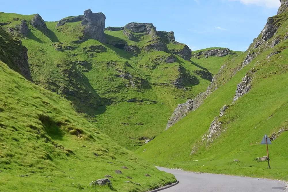
The White Peak is a limestone plateau broken by narrow, often steep-sided dales. Water drains through the soluble rock, creating caves, springs, dry valleys, and rivers that can disappear underground. Fields and drystone walls occupy much of the higher ground, but routes can change character sharply when they drop into a dale. A walk beside a river may still include steep steps, polished limestone, mud, or a crossing made difficult by high water.
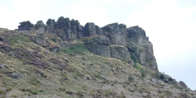
The Dark Peak belongs to the Pennine uplands. Its gritstone edges, peat moors, broad plateaux, and reservoirs create longer stretches of open ground with fewer obvious landmarks. The hills are modest by British mountain standards, yet strong wind, low cloud, and saturated peat can make progress slow. Once a path leaves the main approaches, navigation and the condition of the ground tend to matter sooner.
This is the useful part of the White Peak and Dark Peak distinction: it helps predict the terrain. It is less useful as a difficulty rating. Some White Peak paths are steep and slippery, while a well-used Dark Peak viewpoint may have a short, surfaced approach. The route and the conditions still decide what sort of day it becomes.
White Peak and Dark Peak at a glance
| Decision | White Peak | Dark Peak |
| Landscape | Limestone plateau, enclosed fields, wooded and open dales, clear streams, caves | Gritstone edges, peat moorland, high plateaux, cloughs, reservoirs |
| Walking | More short and medium options; dale paths can still be steep, wet, or slippery | More exposure and bigger-feeling days; navigation and ground conditions matter sooner |
| Other activities | Traffic-free cycling, heritage, towns, villages, caves, and family days | Climbing, fell running, mountain biking, reservoirs, and moorland walking |
| Best bases | Bakewell, Buxton, Hartington, Tideswell, and villages around the dales | Edale, Hathersage, Hayfield, Glossop, and the Hope Valley |
| Best suited to | First visits, mixed groups, families, flexible weekends, and gentler cycling | Walkers, climbers, photographers, and visitors who want the uplands to be the trip |
| Main drawback | Popular dales and towns can be very busy; roads between villages are slow | Poor visibility and wet ground can remove much of the reward and increase the commitment |
Choose the Dark Peak when the uplands are the point
The Dark Peak earns its place in a trip through the days that are difficult to reproduce elsewhere in the National Park. Kinder Scout and Bleaklow are broad moorland plateaux rather than pointed summits. Routes across them weave through peat channels known as groughs, pass gritstone outcrops, and cross open ground where the next path or landmark may not be obvious. Edale is the main starting point for the southern side of Kinder Scout, the Pennine Way, and the Great Ridge; Hayfield approaches Kinder Scout from the west, while Glossop is better placed for Bleaklow and the Longdendale valley.
That doesn’t mean a first Dark Peak walk has to be a plateau crossing. The National Trust’s Mam Tor circular walk is three miles long and starts at Mam Nick car park, between Castleton and Edale. Stone steps and a pitched path lead towards the summit before the route follows part of the Great Ridge and returns over rougher ground. It gives a clear introduction to the wider landscape without the distance or navigational demands of Kinder Scout or Bleaklow, although steep sections, wind, ice, and low cloud still need to be taken seriously.
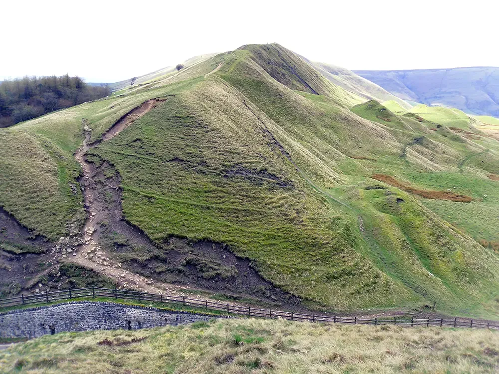
Farther east, the gritstone edges offer shorter days with a strong sense of being in the hills. Stanage Edge and Burbage Rocks rise above the Hope Valley and the western edge of Sheffield, followed farther south by Froggatt Edge and Curbar Edge. The edge itself provides a feature to follow, and the number of access points makes it easier to adjust a route than it would be on an open plateau. This is also the main climbing area. Fell runners and mountain bikers have plenty of options, though access rights and the suitability of individual routes still need checking.
The limitation is that the Dark Peak’s best qualities are closely tied to the conditions. Low cloud can remove the views from an edge walk and make a plateau much harder to navigate; saturated peat turns distance into time and effort. The woodland and reservoir paths of the Upper Derwent Valley offer lower alternatives around Ladybower Reservoir, Derwent Reservoir, and Howden Reservoir. They can rescue a day outdoors, but they don’t replace a moorland crossing if that was the purpose of the trip.
The White Peak gives you more ways to change the day
The White Peak is less dependent on one main outing. Bakewell, Monyash, Youlgreave, Hartington, and Tideswell sit within a close network of fields, villages, and limestone dales, so routes of different lengths can cover much of the same ground. Cutting a walk short need not strip out the reason for doing it: a smaller circuit may still include a dale, open farmland, and somewhere to stop in a village.
The National Trust trail from Ilam Park to the Dovedale Stepping Stones is a manageable introduction. It crosses Ilam village and farmland, descends to the southern entrance of Dovedale, and follows the River Dove to the stones. The route is easy to understand, which is one reason it attracts large numbers of visitors, but it should not be mistaken for an entirely easy surface. Steps, field paths, and uneven ground all feature, and wet limestone or high water can make the final section awkward. Longer routes through Lathkill Dale, Chee Dale, Monsal Dale, or Wolfscote Dale shift the focus away from one famous crossing and give a better sense of the wider limestone landscape.
There is more to fall back on away from the footpaths. The Monsal Trail, Tissington Trail, and High Peak Trail follow former railway lines, keeping cyclists away from fast road traffic and avoiding many of the gradients on the roads around them. The 8.5-mile Monsal Trail has several access points, so a ride can be as short or as long as the day allows. Bakewell and Buxton can also occupy part of a day, while Chatsworth House, Haddon Hall, local museums, and the show caves around Castleton provide alternatives when a long walk has lost its appeal.

That flexibility is not the same as protection from bad weather. Rivers can rise quickly, shaded paths stay wet, and polished limestone becomes particularly slippery. The difference is that a change of plan is less likely to remove the whole point of choosing the White Peak.
Where you stay can soften the divide
Bakewell is the most useful White Peak base for a varied first visit. Monsal Dale, Lathkill Dale, Chatsworth House, Haddon Hall, and several eastern dales are within reach, and the town has enough accommodation and places to eat for a weekend. The trade-off is its popularity, particularly when traffic builds at busy times. Buxton, on the western edge of the limestone area, makes more sense when town facilities and indoor options carry greater weight. Hartington is smaller and better placed for a trip focused on the dales around the upper River Dove.
Dark Peak bases are more closely tied to a particular part of the uplands. Edale puts walkers below Kinder Scout and the Great Ridge but offers relatively little when the weather closes in. Hathersage has more everyday services and straightforward access to Stanage Edge and the eastern gritstone edges. Hayfield is useful for the western approaches to Kinder Scout, especially for visitors arriving from Greater Manchester, while Glossop is the stronger choice for Bleaklow and Longdendale.
Castleton and the wider Hope Valley make the boundary much less important. Mam Tor and the Great Ridge rise above Castleton, while Cave Dale, Peak Cavern, Peveril Castle, and the Limestone Way connect the village with the limestone country. Hathersage and Edale extend the choice east and north. For a group split between the two landscapes, or for a short break booked before the forecast is known, the Hope Valley is the most practical compromise.
Which part of the Peak District should you visit?
Choose the White Peak if you want walking to sit alongside cycling, towns, historic places, caves, or shorter outings. It is the safer recommendation for a first visit, a mixed-interest group, or a weekend that still needs to work after a change in the weather.
Choose the Dark Peak if the trip is built around moorland walking, gritstone climbing, exposed edges, or longer upland routes. The rewards are more specific, and so are the demands: visibility, wind, wet ground, and the experience of the group have a greater say in whether the main plan remains worthwhile.
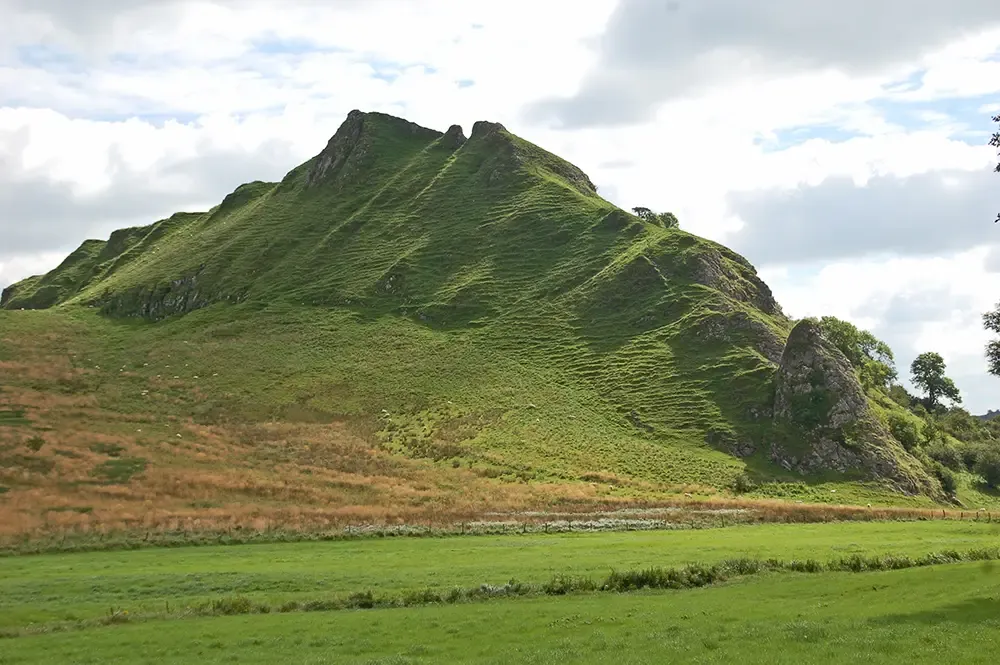
If the choice still feels too close, stay in the Hope Valley. It keeps limestone dales, gritstone edges, and open moorland within reach, so the final decision can be made when the conditions are known rather than when the accommodation is booked. Castleton is a particularly useful base for exploring both landscapes, while visitors travelling by public transport can compare the wider options in our guide to the Peak District’s best bases for a walking weekend without a car.